Airway Heights was founded in 1942 and officially incorporated on April 19, 1955. It was started as an accumulation of businesses to serve residents driving to and from duty at the Spokane Army Air Depot which later became Fairchild Air Force Base.
Even with the incorporation as a city, Airway Heights was recognized less as a final destination and more as someplace people traveled through. That perception has changed over time, however.
The Naming of Airway Heights
The city’s name was taken from its close proximity to the runways at Fairchild Air Force Base and the Spokane International Airport.
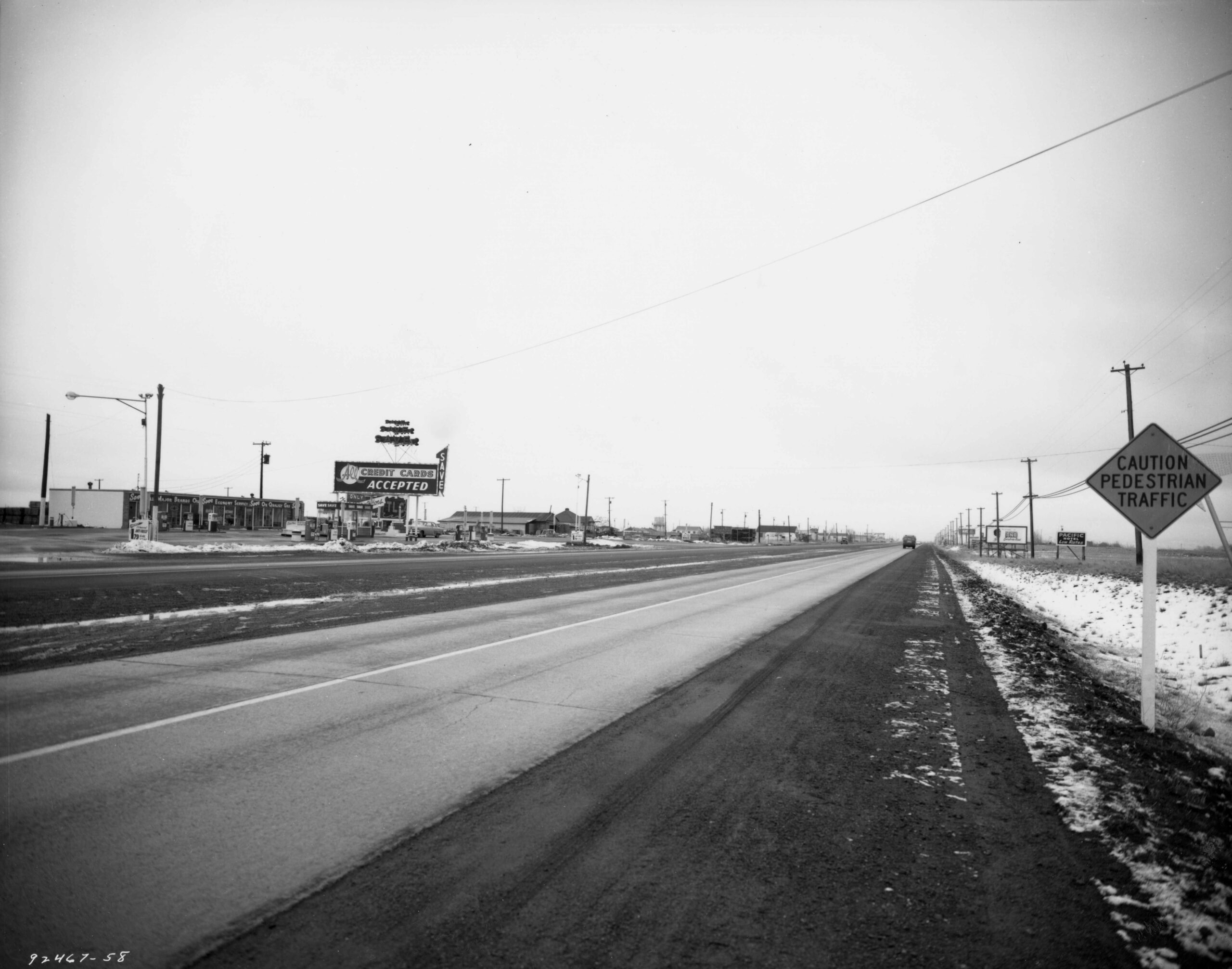
The “heights” in the city’s name refers to its location at a higher elevation than the city center of Spokane which is eight miles away. When driving into Airway Heights along U.S. Route 2 (known locally as the Sunset Highway), you will notice a climb of over 500 feet from downtown Spokane. Airway Heights emerged between Fairchild Air Force Base and the roadway linkage from the airport back to Spokane along US Highway 2.
Historic Use of the Land
The land around Airway Heights lies within what were the traditional use areas of the Spokane and other Salish speaking Indian tribes prior to European contact.
A Battle of the Spokane Plains took place on September 5, 1858, in which U.S. Troops under the command of Colonel George Wright defeated the Coeur d’Alene, Palouse, and Spokane Indians. The battle resulted from a skirmish that had erupted when the Indians refused passage to a military expedition under Lt. Colonel E.J. Steptoe. There is a monument to the battle located at the intersection of 1399 S. Dover Road, Medical Lake, and US Highway 2 near the entrance of Fairchild Air Force Base.
Naturally occurring granite in the Airway Heights and Medical Lake areas has been used in the foundations and construction of many buildings in the region. An example is the Westminster United Church of Christ which was built in 1893.
Early Indian trails, traditional use areas, and historic settlements have been identified in the area.


Two Military Airports Established
Although European settlers homesteaded in the area beginning in the 1870s, there were no permanent urban settlements in the area until after the establishment of two military airports:
In 1941, Sunset Field was purchased from Spokane County by the United States War Department and was renamed Geiger Field; the name would continue to be used until it was changed to the Spokane International Airport in 1960.
In 1942, the Spokane Army Air Depot was built which eventually became Fairchild Air Force Base. Its purpose was to repair and maintain aircraft and the focus was on B-17 engines.
A Need for Local Housing
Officials of the Spokane Air Depot saw a need for local housing outside of it which resulted in the establishment of Airway Heights.
In the 1940s, Carl M. and Flora K. Lundstrom were the first to plat land in the Airway Heights area and donate parcels for initial city building. They took these actions with the goal of incorporation in mind. Carl and Flora worked in real estate in Seattle as well as Electric City, Washington (near Grand Coulee Dam) under the name of Rocket Investment Company.
From discussions with the officials at the Spokane Army Air Depot, they purchased a section of land on the north side of U.S. Highway 2 for six dollars per acre.
In the spring of 1942, installation of the electric and water systems began and parcels of land were sold off to build houses. Later that year, Fritz Ziegler and his wife became the first residents. The Lundstroms also built their first home at the corner of Lundstrom Street and 13th Avenue. However, land development was slow due to the lack of available building materials and financing.
Growth of Airway Heights
In August, 1946, with World War II recently ending, the Lundstroms filed for plats of land for the Airway Heights First and Second additions. Streets were then named after town residents such as Ziegler, Beeman, and Lawson. In 1957, the Third Addition was platted. In that year, the first motel was built by the Loffler Family. It was named the Airway Heights Motel.
In 1948, the first area gas station was established in Airway Heights. It was located at Hayford Road on U.S. Highway 2 and also served as the community post office.
The Lundstroms donated parcels of land over time to help build the community which included land for the first Sunset School in 1951, the Airway Heights Community Church in 1954, the town hall in 1957, and the fire department building in 1963.

Incorporation of Airway Heights in 1955
Sponsors of the town like Carl Lundstrom felt development had been hampered by the county planning board. They were advised that in order to get away from the jurisdiction of the board, they needed to incorporate including U.S. Highway 2 within the town limits.
After paying a $5 incorporation fee and receiving a positive 50-8 vote, one square mile of the West Plains was incorporated to form the City of Airway Heights on April 19,1955. Half of the one square mile town was north of the U.S. Highway 2 and half was south of it.
At the time, the new city had approximately 400 residents with a gas station, café, post office, motel, furniture store, barbershop and a lumberyard.
Carl Lundstrom was elected as the first mayor of Airway Heights in which he ran unopposed. Flora Lundstrom served on the city council for seven years and assisted with operations at the city hall.

Segregation in Airway Heights
Segregation had an impact on the development of Airway Heights.
During World War II, many Americans from different racial classes were fighting for the United States. Even though they were fighting as one for the same country, people of color were not treated equally. For example, African American soldiers were segregated at the Fairchild Air Force base in which they lived in separate barracks.
Carl and Flora Lundstrom were the founders of Airway Heights and racial covenants were made under their Rocket Investment Company.
The wording of the racial covenants read: “No persons of any race other than the white race shall use or occupy any building upon these premises except that this covenant shall not prevent occupancy by domestic servants of a different race domiciled with owner or tenant”.
Airway Heights became a Sundown Town
As a result of the racial covenants, Airway Heights became known as a “Sundown Town”. Sundown Towns were those that practiced a form of racial segregation by excluding non-whites using a combination of discriminatory local laws, intimidation, or violence. Sundown Towns were most prevalent before the 1950s. The term came into use because of signs that directed “colored people” to leave by sundown.
Impact of the Fair Housing Act of 1968
In 1968, the Fair Housing Act was established in the United States intended to protect the buyer or renter of a dwelling from seller or landlord discrimination. The act made it unlawful to refuse to sell, rent to, or negotiate with any person because of that person’s inclusion in a protected class.
Airway Heights continued to grow gradually from a population of 708 in 1960 to 744 in 1969. A building and population boom continued throughout the 1970s with the city more than doubling its size to 1,730 residents by 1980. This was due to the expanding influence of Fairchild Air Force Base and new housing developments.
In 1990, Airway Heights had a population of 1,971; but by 2000, there were 4,526 residents. The growth was largely due to the addition of the Airway Heights Corrections Center (AHCC) by the Washington State Department of Corrections in 1992 which added 1,989 prison inmates as well as employees. The AHCC is a Washington State prison for men and has a working capacity of 2,258 prisoners at minimum and medium security levels. The facility offers prisoners a way to give back to the community by working on local projects.
Growth continued in the surrounding area from which most residents commuted to Airway Heights for basic services. The Northern Quest Resort & Casino was built in 2000 and the Spokane Tribe Resort & Casino was built in 2018. In 2020, the population of Airway Heights was 10,757.
Airway Heights is a low to moderate-income community. It has historically embraced military families. Even the number of veterans living in the area has continued to grow as well as retirees which reflects the strong bond to the area and to Fairchild Airforce Base.
Due to the evolving role of Fairchild in the U.S. military and to changes in base policy, more off-base housing has been encouraged which has resulted in many new residential subdivisions and businesses. The sectors with the most employment growth include education, health, social services, arts, entertainment, recreation, lodging, and food services.
Continued Growth of Airway Heights
In January, 2012, Airway Heights welcomed a new annexation area to the city. It included the properties east of Hayford Road, west of Deer Heights Road, north of McFarlane Road, and south of 6th Avenue. The annexation grew the city to over 6,100 residents (over 8,300 including the Department of Corrections population). The new annexation was a further step in growing the community.
Contemporary development by the Kalispel Tribe’s Camas Institute, the Northern Quest Resort & Casino, and the Spokane Tribe Resort & Casino continue the tribal historic linkages and attachments to the area.
The Northern Quest Casino which opened in 2000 has been a transformative force in reshaping the economic, social, and cultural landscape. It generates over $275 million in annual revenue, employs a staff of nearly 1,500, and has enabled business expansion. Casino profits support essential tribal services. The tribe has donated over $20 million to non-profit organizations. The casino’s success has allowed the Kalispel Tribe to invest in language revitalization, cultural programs, and environmental stewardship.
The Spokane Tribe Casino opened in 2018. It has played a pivotal role in self-sufficiency in job creation, revenue generation, healthcare, education, and cultural preservation.
The casinos and the prison have accounted for much of the travel into and out of Airway Heights.
Airway Heights moved to a city manager form of government from having a mayor govern the city. The move has been good for the city. Overall, the consensus in the community is that good improvements have happened through citizens voicing their needs and desires.
Airway Heights will continue to grow with large capital investments and major new developments in the future.
Formerly undeveloped land, the West Plains area surrounding Airway Heights is the most rapidly growing area in Spokane County. There is a significant focus for business, industry, commercial and residential development. New government facilities as well as industrial office and commercial development have created a destination with a bright future.
Sources
- “Highway Issue in Vote Today”, The Spokesman-Review, April 19, 1955, page 6; “Airway Heights Officially Town”, The Spokesman-Review, April 20, 1955, page 1.
- Pamela Elkind, Dale Lindekugel, and Dick Winchell, A Community Social Profile of Airway Heights: A Community in Transition, (Eastern Washington University, Monograph No. 10, June, 2005) Spokane Public Library – Central, Northwest Room.
- “A Brief History of Airway Heights as Taken from Personal Letters from Original Residents”, City of Airway Heights 2025, website accessed June 1, 2025 (https://cawh.org/history-of-airway-heights/).
- Airway Heights, Wikipedia, website accessed July 10, 2025 (Airway Heights, Washington – Wikipedia).
- Battle of Spokane Plains Monument, Historic Spokane.org, Spokane City/County Historic Preservation Office, website accessed August 30, 2025 (https://properties.historicspokane.org/property/?PropertyID=1985).
- Granite Quarry referencing Medical Lake, HistoricSpokane.org, accessed January 4, 2026 (https://www.historicspokane.org/native-rock-survey-granite).
Image Sources
- Downtown Airway Heights Before Incorporation, Spokane Daily Chronicle, June 17, 1952, page 25.
- Battle of Spokane Plains Monument, 1935, Spokane City/County Historic Preservation Office, accessed August 30, 2025 (https://properties.historicspokane.org/property/?PropertyID=1985).
- Granite Quarry, Medical Lake, Washington, HistoricSpokane.org, accessed January 4, 2026 (https://www.historicspokane.org/native-rock-survey-granite)
- Westminster United Church of Christ in Spokane by Frank Oesterheld, Electronic Records Archivist, Washington State Digital Archives, SpokaneHistorical.org, First Congregational Church (Westminster UCC), Frank Oesterheld, accessed January 4, 2026 (https://spokanehistorical.org/items/show/290#&gid=1&pid=1).
- Airway Heights looking East on Sunset Highway showing Advertising and Billboards, 1958, Museum of Arts & Culture/Eastern Washington Historical Society, Charles Libby Collection, L87-1.92467-58.
- Carl M. Lundstrom 1963, The Spokesman-Review, May 5, 1963, page 22.
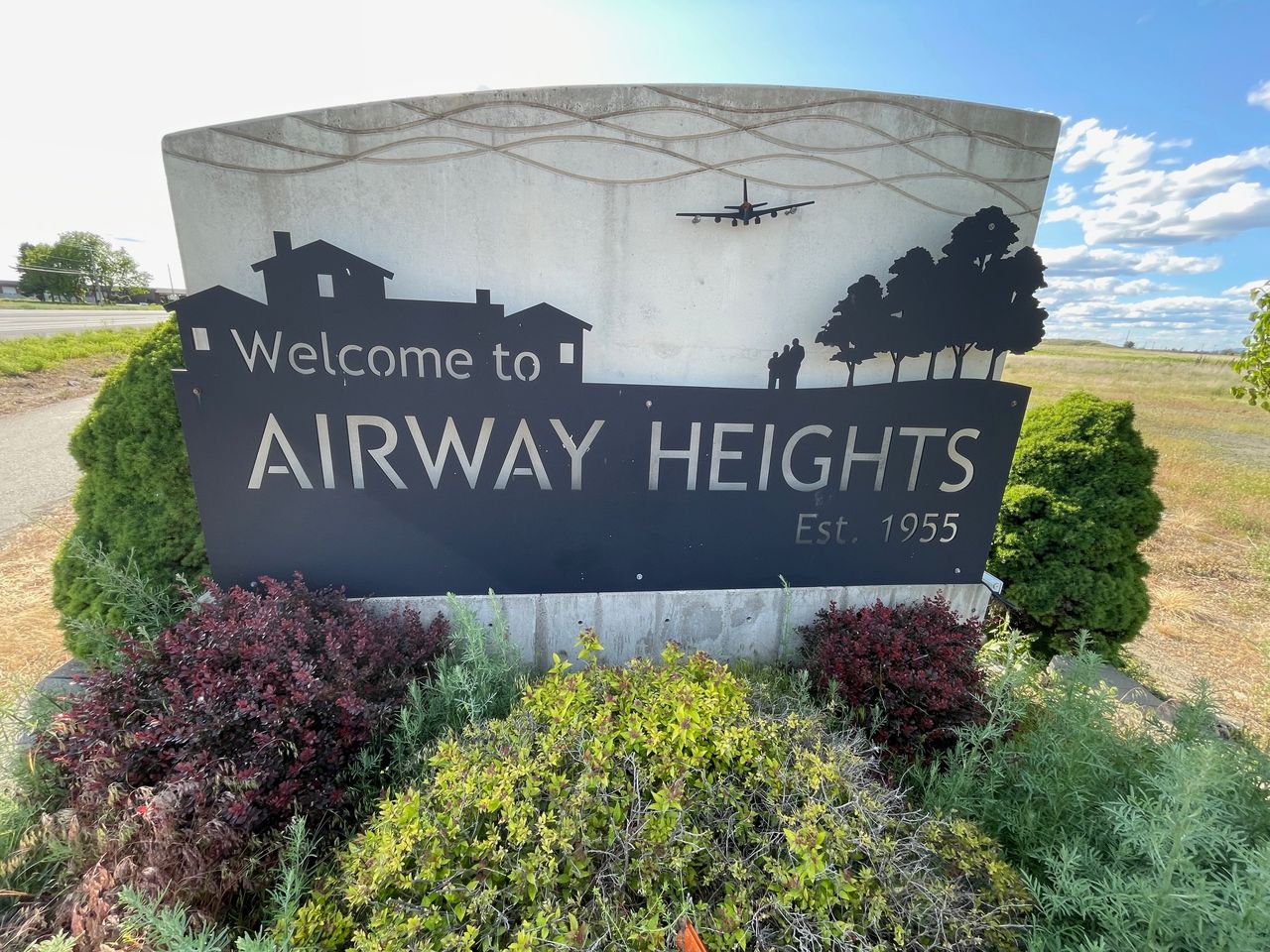
- Airway Heights Welcome Sign, Personal Image taken June 1, 2025.