Sources for Home Page Slide Show Images:
- Monroe Street Bridge with Streetcar, Northwest Museum of Arts & Culture/Eastern Washington State Historical Society, Charles Libby Collection, 1900-1905, L87-1.164.
- Wheat Harvest Near Pullman, Northwest Museum of Arts & Culture/Eastern Washington State Historical Society, Charles Libby Collection, 1930, L87-1.43151-30.
- Expo ’74 Aerial View from Helicopter, Spokane Public Library, Northwest Room, accessed February 20, 2026 (https://lange.spokanelibrary.org/items/show/5269).
- Northern Pacific Passenger Train, Northwest Museum of Arts & Culture/Eastern Washington State Historical Society, Charles Libby Collection, 1926, L87-1.29692-25.
- Apple Trees in Spokane Valley Orchard, 1912, Northwest Museum of Arts & Culture/Eastern Washington State Historical Society, Frank Palmer Collection, L84-327.652.
- National Air Derby and Air Races Felts Field with Cars and Tents 1927, Northwest Museum of Arts & Culture/Eastern Washington State Historical Society, Charles Libby Collection, L95-111.994.
- Early Spokane with Views of Havermale Island, Spokane Falls, and Surrounding Bridges, date unknown, Spokane Falls Gazette accessed March 31, 2026 (https://fallsgazette.com).
- Early Spokane with Views of Downtown and the Post Street and Monroe Street Bridges, date unknown, Spokane Falls Gazette accessed March 31, 2026 (https://fallsgazette.com).
Source for Articles Main Page:
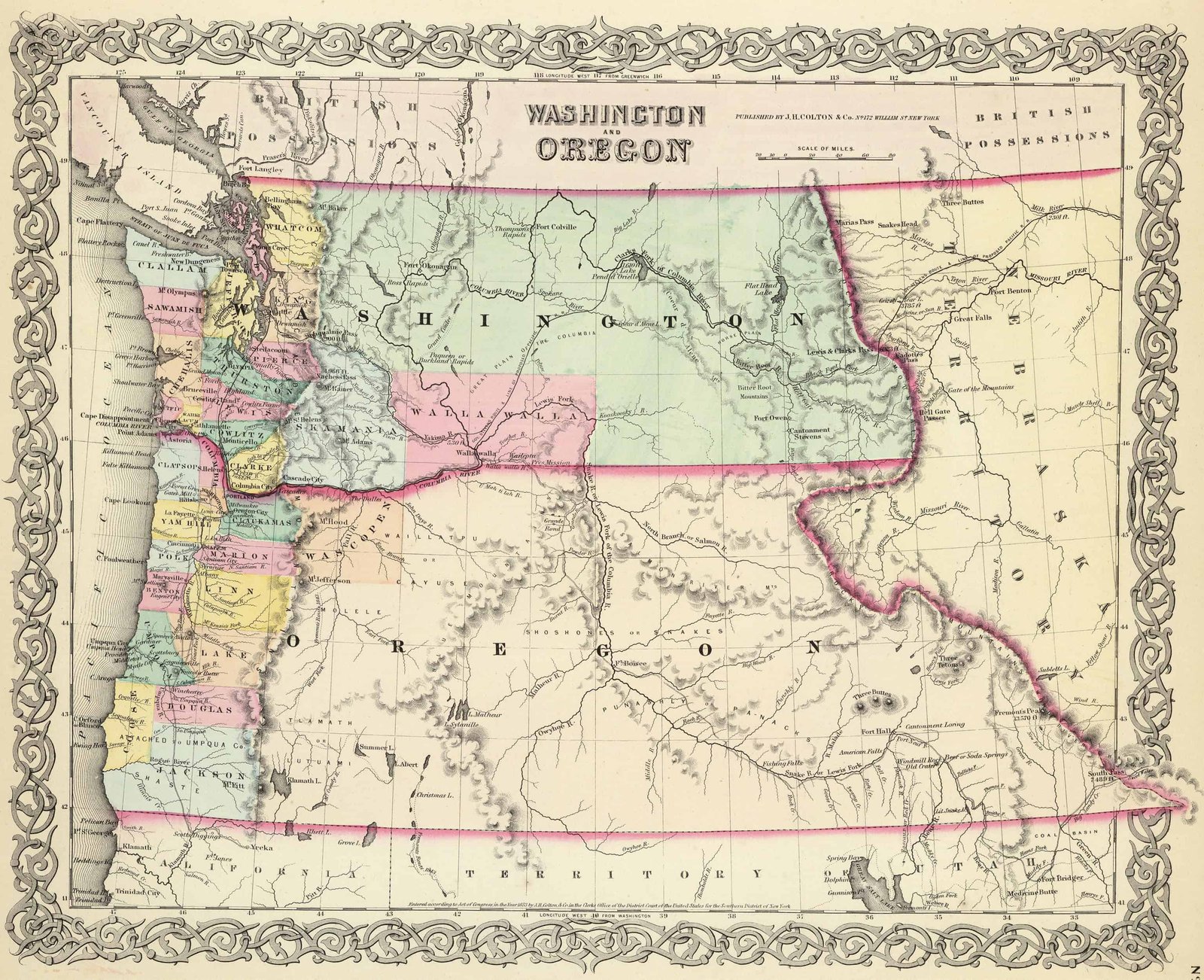
- Map Geeks, Washington and Oregon 1856 Map, Joseph Hutchins Colton & Co., accessed February 23, 2026 (https://mapgeeks.org/wp-content/uploads/1856-Map-of-Washington-and-Oregon.jpg), No. 172.